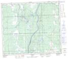
Maps showing Chisholm Mills, 26-28-2-W5, Alberta
Chisholm Mills is a Unincorporated area located in 26-28-2-W5, Alberta.
- Latitude: 54° 54' 34'' North (decimal: 54.9094444)
- Longitude: 114° 10' 8'' West (decimal: -114.1688889)
- Topography Feature Category: Unincorporated area
- Geographical Feature: Post Office
- Canadian Province/Territory: Alberta
- Location: 26-28-2-W5
- Atlas of Canada Locator Map: Chisholm Mills
- GPS Coordinate Locator Map: Chisholm Mills Lat/Long
Chisholm Mills NTS Map Sheets