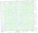
Maps showing McConachie Lake, 79-5-W5, Alberta
McConachie Lake is a Lake located in 79-5-W5, Alberta and has an elevation of 653 meters.
- Latitude: 55° 50' 30'' North (decimal: 55.8416666)
- Longitude: 114° 45' 47'' West (decimal: -114.7630555)
- Topography Feature Category: Lake
- Geographical Feature: Lake
- Canadian Province/Territory: Alberta
- Elevation: 653 meters
- Location: 79-5-W5
- Atlas of Canada Locator Map: McConachie Lake
- GPS Coordinate Locator Map: McConachie Lake Lat/Long
McConachie Lake NTS Map Sheets