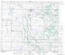
Maps showing Lanuke, 54-12-W4, Alberta
Lanuke is a Unincorporated area located in 54-12-W4, Alberta.
- Latitude: 53° 40' North (decimal: 53.6667000)
- Longitude: 111° 45' West (decimal: -111.7500000)
- Topography Feature Category: Unincorporated area
- Geographical Feature: Locality
- Canadian Province/Territory: Alberta
- Location: 54-12-W4
- GPS Coordinate Locator Map: Lanuke Lat/Long
Lanuke NTS Map Sheets