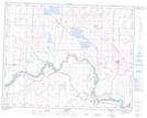
Maps showing Willow Island, 34,35-21-25-W4, Alberta
Willow Island is a Island located in 34,35-21-25-W4, Alberta.
- Latitude: 50° 49' 23'' North (decimal: 50.8230555)
- Longitude: 113° 22' 57'' West (decimal: -113.3825000)
- Topography Feature Category: Island
- Geographical Feature: Island
- Canadian Province/Territory: Alberta
- Location: 34,35-21-25-W4
- Atlas of Canada Locator Map: Willow Island
- GPS Coordinate Locator Map: Willow Island Lat/Long