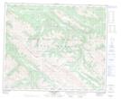
Maps showing Thoreau Creek Pass, Alberta
Thoreau Creek Pass is a Valley located in Alberta and has an elevation of 2009 meters.
- Latitude: 53° 32' 38'' North (decimal: 53.5438888)
- Longitude: 118° 31' 42'' West (decimal: -118.5283332)
- Topography Feature Category: Valley
- Geographical Feature: Pass
- Canadian Province/Territory: Alberta
- Elevation: 2009 meters
- Atlas of Canada Locator Map: Thoreau Creek Pass
- GPS Coordinate Locator Map: Thoreau Creek Pass Lat/Long
Thoreau Creek Pass NTS Map Sheets