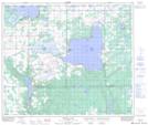
Maps showing Bonnyville Beach, 32-60-6-W4, Alberta
Bonnyville Beach is a Village located in 32-60-6-W4, Alberta and has an elevation of 543 meters.
- Latitude: 54° 14' 8'' North (decimal: 54.2355554)
- Longitude: 110° 51' 49'' West (decimal: -110.8636109)
- Topography Feature Category: Village
- Geographical Feature: Summer Village
- Canadian Province/Territory: Alberta
- Elevation: 543 meters
- Location: 32-60-6-W4
- Atlas of Canada Locator Map: Bonnyville Beach
- GPS Coordinate Locator Map: Bonnyville Beach Lat/Long
Bonnyville Beach NTS Map Sheets