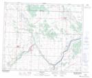
Maps showing Gibbons, 10-56-23-W4, Alberta
Gibbons is a Town located in 10-56-23-W4, Alberta and has an elevation of 658 meters.
- Latitude: 53° 49' 47'' North (decimal: 53.8297222)
- Longitude: 113° 19' 42'' West (decimal: -113.3283333)
- Topography Feature Category: Town
- Geographical Feature: Town
- Canadian Province/Territory: Alberta
- Elevation: 658 meters
- Location: 10-56-23-W4
- Atlas of Canada Locator Map: Gibbons
- GPS Coordinate Locator Map: Gibbons Lat/Long