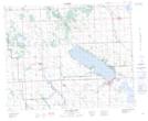
Maps showing Birchcliff, 17,18,19,20-39-1-W5, Alberta
Birchcliff is a Village located in 17,18,19,20-39-1-W5, Alberta and has an elevation of 949 meters.
- Latitude: 52° 21' 43'' North (decimal: 52.3619444)
- Longitude: 114° 7' 5'' West (decimal: -114.1180556)
- Topography Feature Category: Village
- Geographical Feature: Summer Village
- Canadian Province/Territory: Alberta
- Elevation: 949 meters
- Location: 17,18,19,20-39-1-W5
- Atlas of Canada Locator Map: Birchcliff
- GPS Coordinate Locator Map: Birchcliff Lat/Long
Birchcliff NTS Map Sheets