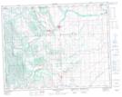
Maps showing Channel Ridge, 3-l9-4-W5, Alberta
Channel Ridge is a Mountain located in 3-l9-4-W5, Alberta.
- Latitude: 50° 34' 50'' North (decimal: 50.5805555)
- Longitude: 114° 29' 34'' West (decimal: -114.4927778)
- Topography Feature Category: Mountain
- Geographical Feature: Ridge
- Canadian Province/Territory: Alberta
- Location: 3-l9-4-W5
- Atlas of Canada Locator Map: Channel Ridge
- GPS Coordinate Locator Map: Channel Ridge Lat/Long
Channel Ridge NTS Map Sheets