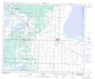
Maps showing Deville, 32-51-20-W4, Alberta
Deville is a Unincorporated area located in 32-51-20-W4, Alberta and has an elevation of 747 meters.
- Latitude: 53° 26' 54'' North (decimal: 53.4483333)
- Longitude: 112° 54' 45'' West (decimal: -112.9124999)
- Topography Feature Category: Unincorporated area
- Geographical Feature: Locality
- Canadian Province/Territory: Alberta
- Elevation: 747 meters
- Location: 32-51-20-W4
- Atlas of Canada Locator Map: Deville
- GPS Coordinate Locator Map: Deville Lat/Long