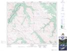
Maps showing Lower Longview Lake, 22-39-21-W5, Alberta
Lower Longview Lake is a Lake located in 22-39-21-W5, Alberta.
- Latitude: 52° 22' 33'' North (decimal: 52.3758333)
- Longitude: 116° 55' 36'' West (decimal: -116.9266666)
- Topography Feature Category: Lake
- Geographical Feature: Lake
- Canadian Province/Territory: Alberta
- Location: 22-39-21-W5
- Atlas of Canada Locator Map: Lower Longview Lake
- GPS Coordinate Locator Map: Lower Longview Lake Lat/Long
Lower Longview Lake NTS Map Sheets