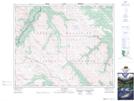
Maps showing Obstruction Lakes, 6-40-20-W5, Alberta
Obstruction Lakes is a Lake located in 6-40-20-W5, Alberta.
- Latitude: 52° 25' 5'' North (decimal: 52.4180555)
- Longitude: 116° 51' 48'' West (decimal: -116.8633332)
- Topography Feature Category: Lake
- Geographical Feature: Lakes
- Canadian Province/Territory: Alberta
- Location: 6-40-20-W5
- Atlas of Canada Locator Map: Obstruction Lakes
- GPS Coordinate Locator Map: Obstruction Lakes Lat/Long
Obstruction Lakes NTS Map Sheets