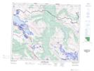
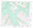
Maps showing Desolation Creek, 53-9-W6, Alberta
Desolation Creek is a River located in 53-9-W6, Alberta and has an elevation of 2170 meters.
- Latitude: 53° 33' 25'' North (decimal: 53.5569444)
- Longitude: 119° 17' 47'' West (decimal: -119.2963888)
- Topography Feature Category: River
- Geographical Feature: Creek
- Canadian Province/Territory: Alberta
- Elevation: 2170 meters
- Location: 53-9-W6
- Atlas of Canada Locator Map: Desolation Creek
- GPS Coordinate Locator Map: Desolation Creek Lat/Long
Desolation Creek NTS Map Sheets