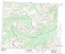
Maps showing Mount De Veber, 54-12-W6, Alberta
Mount De Veber is a Mountain located in 54-12-W6, Alberta and has an elevation of 2318 meters.
- Latitude: 53° 41' 43'' North (decimal: 53.6952777)
- Longitude: 119° 39' 16'' West (decimal: -119.6544444)
- Topography Feature Category: Mountain
- Geographical Feature: Mount
- Canadian Province/Territory: Alberta
- Elevation: 2318 meters
- Location: 54-12-W6
- Atlas of Canada Locator Map: Mount De Veber
- GPS Coordinate Locator Map: Mount De Veber Lat/Long
Mount De Veber NTS Map Sheets