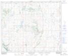
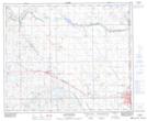
Maps showing Devonia Lake, 49-1-W4, Alberta
Devonia Lake is a Lake located in 49-1-W4, Alberta and has an elevation of 658 meters.
- Latitude: 53° 14' 23'' North (decimal: 53.2397222)
- Longitude: 110° 8' 23'' West (decimal: -110.1397221)
- Topography Feature Category: Lake
- Geographical Feature: Lake
- Canadian Province/Territory: Alberta
- Elevation: 658 meters
- Location: 49-1-W4
- Atlas of Canada Locator Map: Devonia Lake
- GPS Coordinate Locator Map: Devonia Lake Lat/Long
Devonia Lake NTS Map Sheets