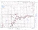
Maps showing Diamond City, 6-10-21-W4, Alberta
Diamond City is a Unincorporated area located in 6-10-21-W4, Alberta and has an elevation of 908 meters.
- Latitude: 49° 47' 44'' North (decimal: 49.7955555)
- Longitude: 112° 50' 20'' West (decimal: -112.8388889)
- Topography Feature Category: Unincorporated area
- Geographical Feature: Hamlet
- Canadian Province/Territory: Alberta
- Elevation: 908 meters
- Location: 6-10-21-W4
- Atlas of Canada Locator Map: Diamond City
- GPS Coordinate Locator Map: Diamond City Lat/Long
Diamond City NTS Map Sheets