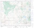
Maps showing Dillberry Lake Provincial Park, 41,42-1-W4, Alberta
Dillberry Lake Provincial Park is a Conservation area located in 41,42-1-W4, Alberta and has an elevation of 626 meters.
- Latitude: 52° 34' North (decimal: 52.5666666)
- Longitude: 110° 2' West (decimal: -110.0333332)
- Topography Feature Category: Conservation area
- Geographical Feature: Provincial Park
- Canadian Province/Territory: Alberta
- Elevation: 626 meters
- Location: 41,42-1-W4
- Atlas of Canada Locator Map: Dillberry Lake Provincial Park
- GPS Coordinate Locator Map: Dillberry Lake Provincial Park Lat/Long