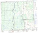
Maps showing Kilsyth Creek, 24-65-2-W5, Alberta
Kilsyth Creek is a River located in 24-65-2-W5, Alberta and has an elevation of 638 meters.
- Latitude: 54° 38' 19'' North (decimal: 54.6386110)
- Longitude: 114° 10' 39'' West (decimal: -114.1774999)
- Topography Feature Category: River
- Geographical Feature: Creek
- Canadian Province/Territory: Alberta
- Elevation: 638 meters
- Location: 24-65-2-W5
- Atlas of Canada Locator Map: Kilsyth Creek
- GPS Coordinate Locator Map: Kilsyth Creek Lat/Long
Kilsyth Creek NTS Map Sheets