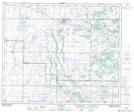
Maps showing Alkali Lake, 53-12,13-W4, Alberta
Alkali Lake is a Lake located in 53-12,13-W4, Alberta and has an elevation of 673 meters.
- Latitude: 53° 32' 55'' North (decimal: 53.5486111)
- Longitude: 111° 46' 00'' West (decimal: -111.7666666)
- Topography Feature Category: Lake
- Geographical Feature: Lake
- Canadian Province/Territory: Alberta
- Elevation: 673 meters
- Location: 53-12,13-W4
- Atlas of Canada Locator Map: Alkali Lake
- GPS Coordinate Locator Map: Alkali Lake Lat/Long
Alkali Lake NTS Map Sheets