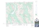
Maps showing Mount Allan, 23-9-W5, Alberta
Mount Allan is a Mountain located in 23-9-W5, Alberta and has an elevation of 2550 meters.
- Latitude: 50° 57' 32'' North (decimal: 50.9588888)
- Longitude: 115° 13' 31'' West (decimal: -115.2252777)
- Topography Feature Category: Mountain
- Geographical Feature: Mount
- Canadian Province/Territory: Alberta
- Elevation: 2550 meters
- Location: 23-9-W5
- Atlas of Canada Locator Map: Mount Allan
- GPS Coordinate Locator Map: Mount Allan Lat/Long
Mount Allan NTS Map Sheets