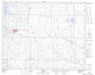
Maps showing Alness, 13-31-13-W4, Alberta
Alness is a Unincorporated area located in 13-31-13-W4, Alberta.
- Latitude: 51° 39' 15'' North (decimal: 51.6541666)
- Longitude: 111° 43' 53'' West (decimal: -111.7313889)
- Topography Feature Category: Unincorporated area
- Geographical Feature: Locality
- Canadian Province/Territory: Alberta
- Location: 13-31-13-W4
- Atlas of Canada Locator Map: Alness
- GPS Coordinate Locator Map: Alness Lat/Long