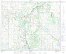
Maps showing Amisk, 26-41-8-W4, Alberta
Amisk is a Village located in 26-41-8-W4, Alberta and has an elevation of 707 meters.
- Latitude: 52° 33' 56'' North (decimal: 52.5655554)
- Longitude: 111° 3' 26'' West (decimal: -111.0572221)
- Topography Feature Category: Village
- Geographical Feature: Village
- Canadian Province/Territory: Alberta
- Elevation: 707 meters
- Location: 26-41-8-W4
- Atlas of Canada Locator Map: Amisk
- GPS Coordinate Locator Map: Amisk Lat/Long
Amisk NTS Map Sheets