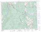
Maps showing Phillipps Peak, 8-5-W5, Alberta
Phillipps Peak is a Mountain located in 8-5-W5, Alberta and has an elevation of 2272 meters.
- Latitude: 49° 39' 47'' North (decimal: 49.6630555)
- Longitude: 114° 39' 27'' West (decimal: -114.6574999)
- Topography Feature Category: Mountain
- Geographical Feature: Peak
- Canadian Province/Territory: Alberta
- Elevation: 2272 meters
- Location: 8-5-W5
- Atlas of Canada Locator Map: Phillipps Peak
- GPS Coordinate Locator Map: Phillipps Peak Lat/Long