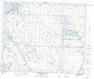
Maps showing Pigeon Lake Creek, 6-45-27-W4, Alberta
Pigeon Lake Creek is a River located in 6-45-27-W4, Alberta and has an elevation of 829 meters.
- Latitude: 52° 57' 55'' North (decimal: 52.9652777)
- Longitude: 113° 59' 1'' West (decimal: -113.9836109)
- Topography Feature Category: River
- Geographical Feature: Creek
- Canadian Province/Territory: Alberta
- Elevation: 829 meters
- Location: 6-45-27-W4
- Atlas of Canada Locator Map: Pigeon Lake Creek
- GPS Coordinate Locator Map: Pigeon Lake Creek Lat/Long
Pigeon Lake Creek NTS Map Sheets