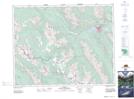
Maps showing Pilot Pond, 18,19-26-13-W5, Alberta
Pilot Pond is a Lake located in 18,19-26-13-W5, Alberta and has an elevation of 1456 meters.
- Latitude: 51° 13' 41'' North (decimal: 51.2280555)
- Longitude: 115° 48' 45'' West (decimal: -115.8125000)
- Topography Feature Category: Lake
- Geographical Feature: Pond
- Canadian Province/Territory: Alberta
- Elevation: 1456 meters
- Location: 18,19-26-13-W5
- Atlas of Canada Locator Map: Pilot Pond
- GPS Coordinate Locator Map: Pilot Pond Lat/Long