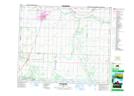
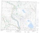
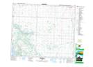
Maps showing Pipestone Creek, 20-46-22-W4, Alberta
Pipestone Creek is a River located in 20-46-22-W4, Alberta and has an elevation of 709 meters.
- Latitude: 52° 58' 33'' North (decimal: 52.9758333)
- Longitude: 113° 9' 23'' West (decimal: -113.1563888)
- Topography Feature Category: River
- Geographical Feature: Creek
- Canadian Province/Territory: Alberta
- Elevation: 709 meters
- Location: 20-46-22-W4
- Atlas of Canada Locator Map: Pipestone Creek
- GPS Coordinate Locator Map: Pipestone Creek Lat/Long
Pipestone Creek NTS Map Sheets