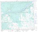
Maps showing Dolberg Lake, 60-7,8-W5, Alberta
Dolberg Lake is a Lake located in 60-7,8-W5, Alberta and has an elevation of 764 meters.
- Latitude: 54° 9' 28'' North (decimal: 54.1577777)
- Longitude: 115° 3' 16'' West (decimal: -115.0544443)
- Topography Feature Category: Lake
- Geographical Feature: Lake
- Canadian Province/Territory: Alberta
- Elevation: 764 meters
- Location: 60-7,8-W5
- Atlas of Canada Locator Map: Dolberg Lake
- GPS Coordinate Locator Map: Dolberg Lake Lat/Long
Dolberg Lake NTS Map Sheets