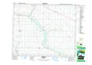
Maps showing Driedmeat Hill, 17-45-19-W4, Alberta
Driedmeat Hill is a Mountain located in 17-45-19-W4, Alberta and has an elevation of 723 meters.
- Latitude: 52° 52' 49'' North (decimal: 52.8802777)
- Longitude: 112° 44' 6'' West (decimal: -112.7350000)
- Topography Feature Category: Mountain
- Geographical Feature: Hill
- Canadian Province/Territory: Alberta
- Elevation: 723 meters
- Location: 17-45-19-W4
- Atlas of Canada Locator Map: Driedmeat Hill
- GPS Coordinate Locator Map: Driedmeat Hill Lat/Long