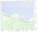
Maps showing Driftpile, 22-73-12-W5, Alberta
Driftpile is a Unincorporated area located in 22-73-12-W5, Alberta and has an elevation of 587 meters.
- Latitude: 55° 20' 21'' North (decimal: 55.3391667)
- Longitude: 115° 46' 56'' West (decimal: -115.7822222)
- Topography Feature Category: Unincorporated area
- Geographical Feature: Locality
- Canadian Province/Territory: Alberta
- Elevation: 587 meters
- Location: 22-73-12-W5
- Atlas of Canada Locator Map: Driftpile
- GPS Coordinate Locator Map: Driftpile Lat/Long
Driftpile NTS Map Sheets