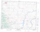
Maps showing Drywood, 24-4-29-W4, Alberta
Drywood is a Unincorporated area located in 24-4-29-W4, Alberta and has an elevation of 1299 meters.
- Latitude: 49° 18' North (decimal: 49.3000000)
- Longitude: 113° 47' West (decimal: -113.7832999)
- Topography Feature Category: Unincorporated area
- Geographical Feature: Locality
- Canadian Province/Territory: Alberta
- Elevation: 1299 meters
- Location: 24-4-29-W4
- Atlas of Canada Locator Map: Drywood
- GPS Coordinate Locator Map: Drywood Lat/Long
Drywood NTS Map Sheets