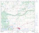
Maps showing La Corey, 13-63-6-W4, Alberta
La Corey is a Unincorporated area located in 13-63-6-W4, Alberta and has an elevation of 556 meters.
- Latitude: 54° 26' 36'' North (decimal: 54.4433333)
- Longitude: 110° 45' 34'' West (decimal: -110.7594443)
- Topography Feature Category: Unincorporated area
- Geographical Feature: Locality
- Canadian Province/Territory: Alberta
- Elevation: 556 meters
- Location: 13-63-6-W4
- Atlas of Canada Locator Map: La Corey
- GPS Coordinate Locator Map: La Corey Lat/Long
La Corey NTS Map Sheets