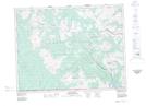
Maps showing La Coulotte Peak, 3-3-W5, Alberta
La Coulotte Peak is a Mountain located in 3-3-W5, Alberta.
- Latitude: 49° 11' 59'' North (decimal: 49.1997222)
- Longitude: 114° 19' 5'' West (decimal: -114.3180556)
- Topography Feature Category: Mountain
- Geographical Feature: Peak
- Canadian Province/Territory: Alberta
- Location: 3-3-W5
- Atlas of Canada Locator Map: La Coulotte Peak
- GPS Coordinate Locator Map: La Coulotte Peak Lat/Long