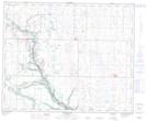
Maps showing Ankerton, 25-43-17-W4, Alberta
Ankerton is a Unincorporated area located in 25-43-17-W4, Alberta and has an elevation of 713 meters.
- Latitude: 52° 43' 49'' North (decimal: 52.7302777)
- Longitude: 112° 19' 48'' West (decimal: -112.3299999)
- Topography Feature Category: Unincorporated area
- Geographical Feature: Locality
- Canadian Province/Territory: Alberta
- Elevation: 713 meters
- Location: 25-43-17-W4
- Atlas of Canada Locator Map: Ankerton
- GPS Coordinate Locator Map: Ankerton Lat/Long
Ankerton NTS Map Sheets