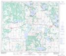
Maps showing Anning, 32-58-11-W4, Alberta
Anning is a Unincorporated area located in 32-58-11-W4, Alberta.
- Latitude: 54° 4' North (decimal: 54.0667000)
- Longitude: 111° 41' West (decimal: -111.6832999)
- Topography Feature Category: Unincorporated area
- Geographical Feature: Locality
- Canadian Province/Territory: Alberta
- Location: 32-58-11-W4
- GPS Coordinate Locator Map: Anning Lat/Long
Anning NTS Map Sheets