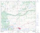
Maps showing Anshaw, 20-61-6-W4, Alberta
Anshaw is a Unincorporated area located in 20-61-6-W4, Alberta.
- Latitude: 54° 17' North (decimal: 54.2832999)
- Longitude: 110° 51' West (decimal: -110.8499999)
- Topography Feature Category: Unincorporated area
- Geographical Feature: Station
- Canadian Province/Territory: Alberta
- Location: 20-61-6-W4
- GPS Coordinate Locator Map: Anshaw Lat/Long
Anshaw NTS Map Sheets