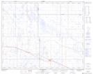
Maps showing Antelope Lake, 31,32-9-W4, Alberta
Antelope Lake is a Lake located in 31,32-9-W4, Alberta and has an elevation of 756 meters.
- Latitude: 51° 40' 10'' North (decimal: 51.6694444)
- Longitude: 111° 14' 57'' West (decimal: -111.2491667)
- Topography Feature Category: Lake
- Geographical Feature: Lake
- Canadian Province/Territory: Alberta
- Elevation: 756 meters
- Location: 31,32-9-W4
- Atlas of Canada Locator Map: Antelope Lake
- GPS Coordinate Locator Map: Antelope Lake Lat/Long