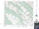
Maps showing Antler Mountain, 43-27-W5, Alberta
Antler Mountain is a Mountain located in 43-27-W5, Alberta and has an elevation of 2302 meters.
- Latitude: 52° 45' 32'' North (decimal: 52.7588889)
- Longitude: 117° 50' 45'' West (decimal: -117.8458332)
- Topography Feature Category: Mountain
- Geographical Feature: Mountain
- Canadian Province/Territory: Alberta
- Elevation: 2302 meters
- Location: 43-27-W5
- Atlas of Canada Locator Map: Antler Mountain
- GPS Coordinate Locator Map: Antler Mountain Lat/Long
Antler Mountain NTS Map Sheets