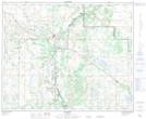
Maps showing Archie Hill, 43-8-W4, Alberta
Archie Hill is a Mountain located in 43-8-W4, Alberta and has an elevation of 680 meters.
- Latitude: 52° 44' 40'' North (decimal: 52.7444444)
- Longitude: 111° 6' 7'' West (decimal: -111.1019444)
- Topography Feature Category: Mountain
- Geographical Feature: Hill
- Canadian Province/Territory: Alberta
- Elevation: 680 meters
- Location: 43-8-W4
- Atlas of Canada Locator Map: Archie Hill
- GPS Coordinate Locator Map: Archie Hill Lat/Long
Archie Hill NTS Map Sheets