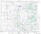
Maps showing Plain Lake, 53-12-W4, Alberta
Plain Lake is a Lake located in 53-12-W4, Alberta and has an elevation of 648 meters.
- Latitude: 53° 36' 21'' North (decimal: 53.6058332)
- Longitude: 111° 41' 48'' West (decimal: -111.6966667)
- Topography Feature Category: Lake
- Geographical Feature: Lake
- Canadian Province/Territory: Alberta
- Elevation: 648 meters
- Location: 53-12-W4
- Atlas of Canada Locator Map: Plain Lake
- GPS Coordinate Locator Map: Plain Lake Lat/Long
Plain Lake NTS Map Sheets