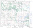
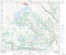
Maps showing Lac Poitras, 24-56-11-W4, Alberta
Lac Poitras is a Lake located in 24-56-11-W4, Alberta and has an elevation of 615 meters.
- Latitude: 53° 51' 30'' North (decimal: 53.8583333)
- Longitude: 111° 30' 32'' West (decimal: -111.5088888)
- Topography Feature Category: Lake
- Geographical Feature: Lac
- Canadian Province/Territory: Alberta
- Elevation: 615 meters
- Location: 24-56-11-W4
- Atlas of Canada Locator Map: Lac Poitras
- GPS Coordinate Locator Map: Lac Poitras Lat/Long
Lac Poitras NTS Map Sheets