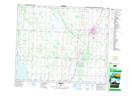
Maps showing Ponoka, 4-43-25-W4, Alberta
Ponoka is a Town located in 4-43-25-W4, Alberta and has an elevation of 807 meters.
- Latitude: 52° 40' 30'' North (decimal: 52.6749999)
- Longitude: 113° 34' 48'' West (decimal: -113.5799999)
- Topography Feature Category: Town
- Geographical Feature: Town
- Canadian Province/Territory: Alberta
- Elevation: 807 meters
- Location: 4-43-25-W4
- Atlas of Canada Locator Map: Ponoka
- GPS Coordinate Locator Map: Ponoka Lat/Long