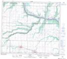
Maps showing Poplar Ridge, 11-80-7-W6, Alberta
Poplar Ridge is a Unincorporated area located in 11-80-7-W6, Alberta and has an elevation of 617 meters.
- Latitude: 55° 55' 39'' North (decimal: 55.9275000)
- Longitude: 118° 59' 32'' West (decimal: -118.9922221)
- Topography Feature Category: Unincorporated area
- Geographical Feature: Locality
- Canadian Province/Territory: Alberta
- Elevation: 617 meters
- Location: 11-80-7-W6
- Atlas of Canada Locator Map: Poplar Ridge
- GPS Coordinate Locator Map: Poplar Ridge Lat/Long
Poplar Ridge NTS Map Sheets