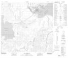
Maps showing Potato Island, 111,112-7,8-W4, Alberta
Potato Island is a Island located in 111,112-7,8-W4, Alberta and has an elevation of 228 meters.
- Latitude: 58° 41' 17'' North (decimal: 58.6880555)
- Longitude: 111° 9' 49'' West (decimal: -111.1636111)
- Topography Feature Category: Island
- Geographical Feature: Island
- Canadian Province/Territory: Alberta
- Elevation: 228 meters
- Location: 111,112-7,8-W4
- Atlas of Canada Locator Map: Potato Island
- GPS Coordinate Locator Map: Potato Island Lat/Long
Potato Island NTS Map Sheets