Canada Topographic Maps

Prairie Creek Topo Maps

Topography maps and Latitude/Longitude Location

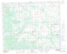
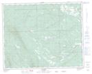
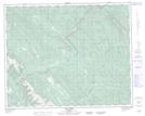
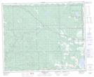
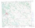
Maps showing Prairie Creek, 39-7-W5, Alberta

Prairie Creek is a River located in 39-7-W5, Alberta and has an elevation of 1022 meters.

  • Latitude: 52° 19' 46'' North   (decimal: 52.3294444)
  • Longitude: 114° 55' 13'' West   (decimal: -114.9202777)
  • Topography Feature Category: River
  • Geographical Feature: Creek
  • Canadian Province/Territory: Alberta
  • Elevation: 1022 meters
  • Location: 39-7-W5
  • Atlas of Canada Locator Map: Prairie Creek
  • GPS Coordinate Locator Map: Prairie Creek Lat/Long

Prairie Creek NTS Map Sheets

083B02 Caroline Topographic Map at 1:50,000 scale

083B03 Tay River Topographic Map at 1:50,000 scale

083B04 Elk Creek Topographic Map at 1:50,000 scale

083B06 Crimson Lake Topographic Map at 1:50,000 scale

083B07 Rocky Mountain House Topographic Map at 1:50,000 scale

083B Rocky Mountain House Topographic Map at 1:250,000 scale

 
Buy Topographic Maps DVD
Newsletter Sign-up

Yes, I want to receive map store discounts.


Bookmark and Share