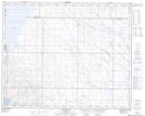
Maps showing Dowling, 25-32-15-W4, Alberta
Dowling is a Unincorporated area located in 25-32-15-W4, Alberta.
- Latitude: 51° 46' 20'' North (decimal: 51.7722222)
- Longitude: 111° 59' 58'' West (decimal: -111.9994444)
- Topography Feature Category: Unincorporated area
- Geographical Feature: Railway Point
- Canadian Province/Territory: Alberta
- Location: 25-32-15-W4
- Atlas of Canada Locator Map: Dowling
- GPS Coordinate Locator Map: Dowling Lat/Long