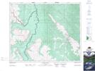
Maps showing Dowling Ford, 21-42-20-W5, Alberta
Dowling Ford is a River feature located in 21-42-20-W5, Alberta and has an elevation of 1568 meters.
- Latitude: 52° 38' 15'' North (decimal: 52.6375000)
- Longitude: 116° 49' 18'' West (decimal: -116.8216667)
- Topography Feature Category: River feature
- Geographical Feature: Ford
- Canadian Province/Territory: Alberta
- Elevation: 1568 meters
- Location: 21-42-20-W5
- Atlas of Canada Locator Map: Dowling Ford
- GPS Coordinate Locator Map: Dowling Ford Lat/Long
Dowling Ford NTS Map Sheets