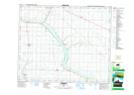
Maps showing Duhamel, 27-45-21-W4, Alberta
Duhamel is a Unincorporated area located in 27-45-21-W4, Alberta and has an elevation of 741 meters.
- Latitude: 52° 54' 56'' North (decimal: 52.9155555)
- Longitude: 112° 57' 48'' West (decimal: -112.9633332)
- Topography Feature Category: Unincorporated area
- Geographical Feature: Locality
- Canadian Province/Territory: Alberta
- Elevation: 741 meters
- Location: 27-45-21-W4
- Atlas of Canada Locator Map: Duhamel
- GPS Coordinate Locator Map: Duhamel Lat/Long