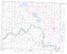
Maps showing Eagle Hill, 21-23-24-W4, Alberta
Eagle Hill is a Mountain located in 21-23-24-W4, Alberta and has an elevation of 945 meters.
- Latitude: 50° 58' 9'' North (decimal: 50.9691666)
- Longitude: 113° 17' 13'' West (decimal: -113.2869444)
- Topography Feature Category: Mountain
- Geographical Feature: Hill
- Canadian Province/Territory: Alberta
- Elevation: 945 meters
- Location: 21-23-24-W4
- Atlas of Canada Locator Map: Eagle Hill
- GPS Coordinate Locator Map: Eagle Hill Lat/Long