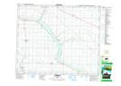
Maps showing Edberg, 14-44-20-W4, Alberta
Edberg is a Village located in 14-44-20-W4, Alberta and has an elevation of 789 meters.
- Latitude: 52° 47' 5'' North (decimal: 52.7847222)
- Longitude: 112° 47' 21'' West (decimal: -112.7891667)
- Topography Feature Category: Village
- Geographical Feature: Village
- Canadian Province/Territory: Alberta
- Elevation: 789 meters
- Location: 14-44-20-W4
- Atlas of Canada Locator Map: Edberg
- GPS Coordinate Locator Map: Edberg Lat/Long