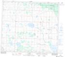
Maps showing La Glace Lake, 73,74-8,9-W6, Alberta
La Glace Lake is a Lake located in 73,74-8,9-W6, Alberta and has an elevation of 722 meters.
- Latitude: 55° 23' 6'' North (decimal: 55.3850000)
- Longitude: 119° 14' 32'' West (decimal: -119.2422222)
- Topography Feature Category: Lake
- Geographical Feature: Lake
- Canadian Province/Territory: Alberta
- Elevation: 722 meters
- Location: 73,74-8,9-W6
- Atlas of Canada Locator Map: La Glace Lake
- GPS Coordinate Locator Map: La Glace Lake Lat/Long
La Glace Lake NTS Map Sheets